
 Map of Antarctica (Credit AAD)
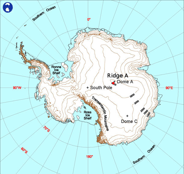
Ridge A (81°40.41'S, 72°42.96'E) is 159 kilometres from Dome A (the highest point on the Antarctic plateau at about 4,098 meters). The elevation of Ridge A, at 4,035 meters above sea level, and its latitude, make it one of the coldest places on earth. During mid-winter the temperature can drop below -80°C and, due to the extremely cold temperature, the air contains nearly no water vapour.